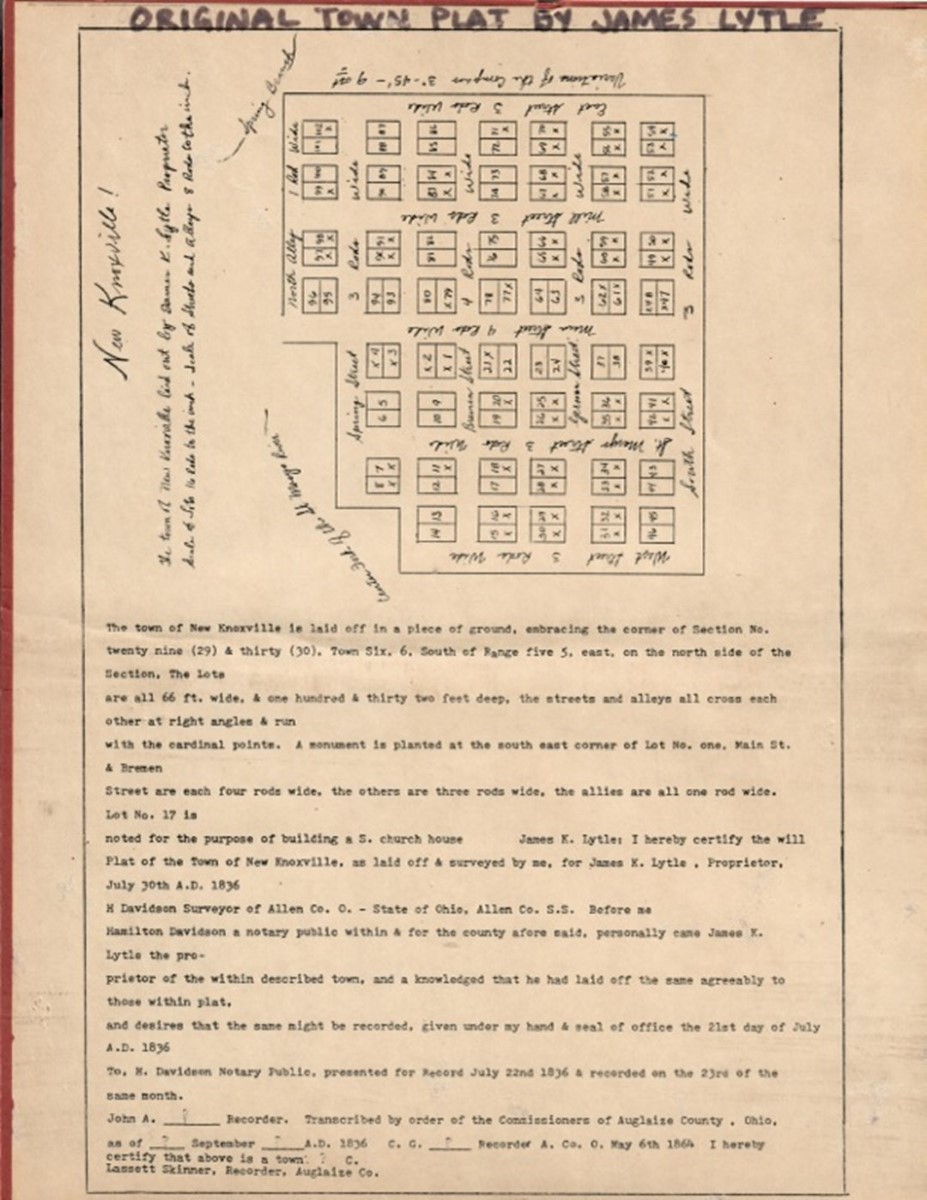

Below is an image of the original plat of New Knoxville. The town was originally platted as Knoxville in 1836 by James Knox Lytle, a Scotch-Irishman by descent. The plat was surveyed by Hamilton Davidson, Surveyor of Allen County, and he notarized it on June 30, 1836. James K. Lytle was the enterprising proprietor of the property, which was then in Allen County. Washington Township was established as a separate civil entity on December 1, 1836, and Auglaize County was established in 1848.
The town was originally laid out with four east-west streets (Spring, Bremen, German, South) and five north-south streets (West, St. Marys, Main, Mill, East). The north boundary is defined by Spring Street and the alley to the north of it. The west side is bounded by West Street and the east side by East Street. The original south boundary is South Street. Spring Street and the north alley are cut off on the northwest corner by the creek known as the Center Fork of the St. Marys River.
The widths of the streets are specified in rods, which was a commonly used unit of measurement at that time. A rod equals 5 ½ yards or 16 ½ feet. Main Street and Bremen Street are specified to be four rods wide (66 feet), and all other streets are three rods wide (49 ½ feet). Alleys are one rod in width. The lots are specified in feet, but they are in even multiples of rods (66 feet wide and 132 feet deep).
Note:Although the rod is very seldom mentioned today, its influence as a unit of measurement still applies to some commonly used items, particularly things pertaining to farming. New rolls of wire fence are 330 feet (20 rods), and rolls of barbed wire are 1320 feet (80 rods).